Summary
Jharkhand’s Principal Chief Conservator of Forests advocated for the immediate adoption of green technology to curb environmental damage across the state on March 22, 2026. This move seeks to modernize forest management and industrial oversight in a region where mining and heavy industry often clash with conservation efforts. By integrating digital monitoring and sustainable tools, the state aims to protect its 23,605 square kilometers of forest cover while maintaining its status as a major industrial hub.
Question Answer Who took the action? Jharkhand's top forest officer (PCCF) What happened? A formal call to adopt green technology for environmental protection When did it happen? March 22, 2026 How much changed? A shift from traditional manual oversight to tech-driven monitoring Why does it matter? It balances mining economic needs with forest conservation Who is affected? Mining companies, forest departments, and local tribal communities What was the earlier level? Reliance on manual patrolling and traditional conservation methods What happens next? Implementation of drones, GIS mapping, and eco-friendly mining rulesMain Impact
The push for green technology marks a change in how Jharkhand manages its natural resources. For decades, the state has struggled to monitor vast, remote forest areas where illegal logging and mining encroachment occur. The adoption of tools like satellite imagery and real-time sensors allows the forest department to see changes in the canopy almost instantly. This transition reduces the reliance on physical patrols in difficult terrain, making environmental protection more efficient and less prone to human error or corruption.
Key Details
What Happened
The state's top forest official outlined a strategy to use modern tools to lower the carbon footprint of industrial activities. This includes using Geographic Information Systems (GIS) to map forest boundaries more accurately and employing drones for "seed bombing" to speed up reforestation in degraded areas. The official emphasized that technology is no longer an option but a necessity to prevent further loss of biodiversity in the Chota Nagpur Plateau region.
Important Numbers and Facts
Jharkhand holds nearly 40% of India’s mineral wealth, yet it also maintains a forest cover of roughly 29.76%. The balance between these two facts is the primary driver for this new tech-focused policy. The forest department plans to deploy specialized sensors to monitor air quality and water runoff near coal mines to ensure companies follow environmental laws.
Key Fact Value Main person or group Jharkhand Forest Department Main action Adoption of green technology and digital monitoring Date or period March 2026 Forest cover area Approximately 23,605 sq km Previous level Manual surveillance and reactive enforcement Current level Proactive, tech-led environmental management Main effect Faster detection of forest loss and pollution Next step Training staff on drone and GIS operationsBackground and Context
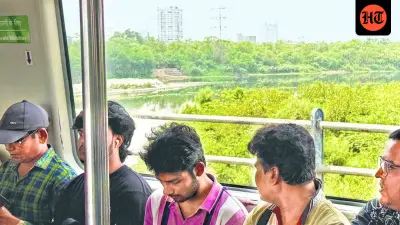
Jharkhand, which translates to "The Land of Forests," was created with the goal of protecting its unique ecology and tribal heritage. However, the state is also home to some of the largest coal, iron ore, and copper mines in India. This creates a constant tension between industrial growth and nature. Traditional methods of forest protection have often failed because the areas are too large to patrol on foot and some regions are hard to reach due to geography. Green technology offers a way to watch over these areas from a distance, providing data that can be used in court to hold polluters accountable.
Real Example or Practical Case
A practical example of this tech in action is the use of LiDAR (Light Detection and Ranging) to map the density of forests. In a pilot project, the department can use these aerial scans to identify exactly where the forest floor is being disturbed by unauthorized small-scale mining. Instead of sending a team to wander through miles of woods, the department can send a drone to a specific coordinate to take high-definition photos. This evidence is then used to issue immediate stop-work orders to the offending parties.
Who Is Affected
Mining and industrial firms are the most affected by this change. They will likely face stricter monitoring and may be required to invest in their own green tech to stay compliant with state laws. Local tribal communities, who rely on the forest for their livelihood, stand to benefit from better-protected ecosystems and cleaner water sources. Additionally, forest officers will need to undergo technical training to handle the new software and hardware being introduced into their daily routines.
Public or Industry Reaction
Environmental groups have welcomed the move, noting that digital records are harder to manipulate than paper logs. However, some industrial leaders have expressed concern about the cost of compliance. They argue that while green tech is helpful, the government should provide subsidies or clear guidelines to help smaller firms transition to these cleaner methods without going out of business.
Risks, Limits, or What to Watch
The primary risk is the "digital divide" within the department. Many veteran forest guards may find it difficult to switch from traditional methods to using tablets and drones. There is also the issue of hardware maintenance in humid, rugged forest environments. Furthermore, technology alone cannot stop environmental damage if the legal system does not follow through with penalties for those caught by the new monitoring systems. Observers should watch for how much funding the state actually allocates for these high-tech tools in the next budget cycle.
What This Means Going Forward
In the coming months, expect to see more drones in the skies over Jharkhand’s mining belts. The forest department is likely to set up a centralized data hub in Ranchi to track environmental changes in real-time. If successful, this model could be used by other mineral-rich states like Odisha and Chhattisgarh. The long-term goal is to create a "smart forest" system where every acre of land is accounted for and every industrial site is held to a high standard of ecological safety.
Final Take
Protecting Jharkhand's forests requires more than just passion; it requires the precision that only modern technology can provide to hold large-scale industry accountable.
Frequently Asked Questions
What kind of green tech will Jharkhand use?
The state plans to use GIS mapping, drone surveillance, satellite imagery, and remote sensors to monitor forest health and industrial pollution levels.
How will this affect mining companies?
Companies will face more accurate and frequent monitoring, meaning they must strictly follow environmental rules or face data-backed legal action.
Will this help prevent illegal logging?
Yes, by using real-time satellite alerts, the forest department can identify tree loss quickly and send teams directly to the site of the activity.